


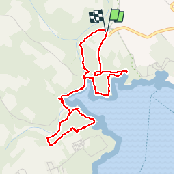
boucle cala mandrago

fab0202
User

Length
5.4 km

Max alt
30 m

Uphill gradient
72 m
Km-Effort
6.4 km

Min alt
0 m

Downhill gradient
72 m
Boucle
Yes
Creation date :
2019-08-24 09:00:47.417
Updated on :
2019-08-26 05:59:12.261
1h39
Difficulty : Easy

FREE GPS app for hiking
 SityTrail
IGN / Geographical institutes
SityTrail Plus
The world is yours!
About
Trail Walking of 5.4 km to be discovered at Balearic Islands, Unknown, Santanyí. This trail is proposed by fab0202.
Description
belle randonnée avec vue sur de superbes criques
Photos


Positioning
Country:
Spain
Region :
Balearic Islands
Department/Province :
Unknown
Municipality :
Santanyí
Location:
Unknown
Start:(Dec)
Start:(UTM)
516432 ; 4356384 (31S) N.
Comments