


Verdon le pavillon

chrifor
User

Length
13.8 km

Max alt
1615 m

Uphill gradient
680 m
Km-Effort
23 km

Min alt
951 m

Downhill gradient
679 m
Boucle
Yes
Creation date :
2019-08-30 08:18:25.683
Updated on :
2019-08-31 08:33:42.487
6h20
Difficulty : Difficult

FREE GPS app for hiking
 SityTrail
IGN / Geographical institutes
SityTrail Plus
The world is yours!
About
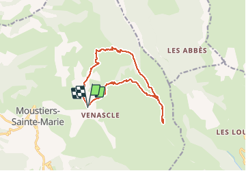
Trail Walking of 13.8 km to be discovered at Provence-Alpes-Côte d'Azur, Alpes-de-Haute-Provence, Moustiers-Sainte-Marie. This trail is proposed by chrifor.
Photos


Positioning
Country:
France
Region :
Provence-Alpes-Côte d'Azur
Department/Province :
Alpes-de-Haute-Provence
Municipality :
Moustiers-Sainte-Marie
Location:
Unknown
Start:(Dec)
Start:(UTM)
278742 ; 4858847 (32T) N.
Comments
rando cotée "difficile" pour la descente du retour rapide et caillouteuse et ...pour la chaleur!