


Col d'Agnel - Le Pin de Sucre

soca
User
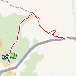

Length
6.1 km

Max alt
3163 m

Uphill gradient
451 m
Km-Effort
12.1 km

Min alt
2708 m

Downhill gradient
452 m
Boucle
Yes
Creation date :
2019-08-31 16:14:19.495
Updated on :
2019-08-31 16:15:21.021
2h30
Difficulty : Difficult

FREE GPS app for hiking
 SityTrail
IGN / Geographical institutes
SityTrail Plus
The world is yours!
About
Trail Walking of 6.1 km to be discovered at Provence-Alpes-Côte d'Azur, Hautes-Alpes, Molines-en-Queyras. This trail is proposed by soca.
Positioning
Country:
France
Region :
Provence-Alpes-Côte d'Azur
Department/Province :
Hautes-Alpes
Municipality :
Molines-en-Queyras
Location:
Unknown
Start:(Dec)
Start:(UTM)
339933 ; 4949993 (32T) N.
Comments