


GR34-EtapeII-J04

JMCMoreau
User

Length
23 km

Max alt
56 m

Uphill gradient
509 m
Km-Effort
29 km

Min alt
-1 m

Downhill gradient
471 m
Boucle
No
Creation date :
2019-09-01 02:10:32.18
Updated on :
2023-01-21 17:31:12.271
8h00
Difficulty : Medium

FREE GPS app for hiking
 SityTrail
IGN / Geographical institutes
SityTrail Plus
The world is yours!
About
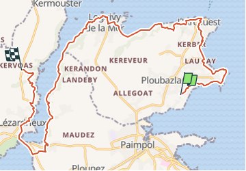
Trail Walking of 23 km to be discovered at Brittany, Côtes-d'Armor, Ploubazlanec. This trail is proposed by JMCMoreau.
Description
Du calvaire de PLoubazlanec (la Croix Cornic) jusqu'à la Crêperie du Moulin à Mer à "Traou Bihan" Hameau de Lézardrieux. adresse 1 Le Moulin À Mer, 22740 Lézardrieux
Positioning
Country:
France
Region :
Brittany
Department/Province :
Côtes-d'Armor
Municipality :
Ploubazlanec
Location:
Unknown
Start:(Dec)
Start:(UTM)
498049 ; 5404803 (30U) N.
Comments
Top