


GR34-EtapeIII-J04

JMCMoreau
User
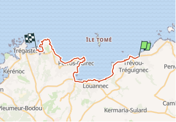

Length
22 km

Max alt
59 m

Uphill gradient
330 m
Km-Effort
26 km

Min alt
-1 m

Downhill gradient
330 m
Boucle
No
Creation date :
2019-09-01 04:08:49.73
Updated on :
2023-01-21 17:35:55.684
6h30
Difficulty : Medium

FREE GPS app for hiking
 SityTrail
IGN / Geographical institutes
SityTrail Plus
The world is yours!
About
Trail Walking of 22 km to be discovered at Brittany, Côtes-d'Armor, Trévou-Tréguignec. This trail is proposed by JMCMoreau.
Description
Depuis la plage de Trestel jusqu'à la plage de Tourony (Ploumanac'h)
6h30 de marche sans pause.
Positioning
Country:
France
Region :
Brittany
Department/Province :
Côtes-d'Armor
Municipality :
Trévou-Tréguignec
Location:
Unknown
Start:(Dec)
Start:(UTM)
474241 ; 5407600 (30U) N.
Comments
Tout OK