


kravnik

AMORUN
User
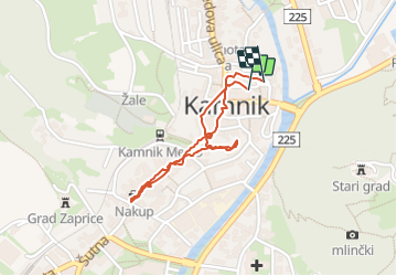

Length
1.6 km

Max alt
389 m

Uphill gradient
16 m
Km-Effort
1.8 km

Min alt
379 m

Downhill gradient
18 m
Boucle
Yes
Creation date :
2019-09-01 12:36:19.262
Updated on :
2019-09-01 13:14:30.454
37m
Difficulty : Very easy

FREE GPS app for hiking
 SityTrail
IGN / Geographical institutes
SityTrail Plus
The world is yours!
About
Trail Walking of 1.6 km to be discovered at Unknown, Unknown, Kamnik. This trail is proposed by AMORUN.
Description
kravnik à pied
Positioning
Country:
Slovenia
Region :
Unknown
Department/Province :
Unknown
Municipality :
Kamnik
Location:
Unknown
Start:(Dec)
Start:(UTM)
470137 ; 5119249 (33T) N.
Comments