Lac Chambon et Tartaret

trevezel
User
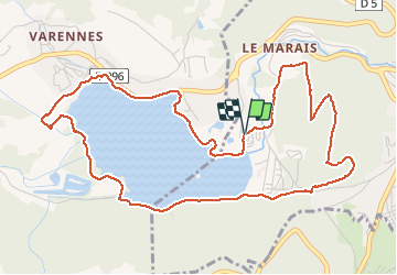

Length
6.4 km

Max alt
957 m

Uphill gradient
160 m
Km-Effort
8.5 km

Min alt
868 m

Downhill gradient
160 m
Boucle
Yes
Creation date :
2019-09-01 14:06:55.567
Updated on :
2019-09-01 15:58:21.928
1h50
Difficulty : Very easy

FREE GPS app for hiking
 SityTrail
IGN / Geographical institutes
SityTrail Plus
The world is yours!
About
Trail Walking of 6.4 km to be discovered at Auvergne-Rhône-Alpes, Puy-de-Dôme, Murol. This trail is proposed by trevezel.
Positioning
Country:
France
Region :
Auvergne-Rhône-Alpes
Department/Province :
Puy-de-Dôme
Municipality :
Murol
Location:
Unknown
Start:(Dec)
Start:(UTM)
494441 ; 5046412 (31T) N.
Comments