


Yellowstone Lower Basin

GOHIER
User
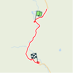

Length
22 km

Max alt
2255 m

Uphill gradient
190 m
Km-Effort
24 km

Min alt
2203 m

Downhill gradient
150 m
Boucle
No
Creation date :
2019-08-31 00:04:16.0
Updated on :
2019-09-05 22:19:32.864
4h07
Difficulty : Unknown

FREE GPS app for hiking
 SityTrail
IGN / Geographical institutes
SityTrail Plus
The world is yours!
About
Trail Walking of 22 km to be discovered at Wyoming, Teton County. This trail is proposed by GOHIER.
Positioning
Country:
United States
Region :
Wyoming
Department/Province :
Teton County
Municipality :
Excelsior Geyser Crater
Location:
Unknown
Start:(Dec)
Start:(UTM)
513018 ; 4930680 (12T) N.
Comments