Trail Equestrian Rives-de-l'Yon - NESMY 2019 - Boucle orange - Photo

NESMY 2019 - Boucle orange

 clbolb7
clbolb7

User

© OpenStreetMap contributors
Length
Length
22 km
Max alt
Max alt
80 m
Uphill gradient
Uphill gradient
197 m
Km-Effort
Km-Effort  
24 km
Min alt
Min alt
24 m
Downhill gradient
Downhill gradient
197 m
Boucle
Boucle
Yes
Creation date :
2019-09-03 06:14:15.91
Updated on :
2020-09-02 06:48:30.291

(0 Reviews)

Equestrian
Equestrian
--
Difficulty : Very easy
Horseback riding
Horseback riding
2m
Difficulty : Easy

Scan this QR Code to open this trail in the SityTrail application

FREE GPS app for hiking

Logo SityTrail SityTrail

IGN / Geographical institutes

Download SityTrail from the App Store Download SityTrail from Google Play

Logo SityTrail SityTrail World

The world is yours!

Download SityTrail from the App Store Download SityTrail from Google Play Download SityTrail on Huawei AppGallery

About

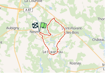
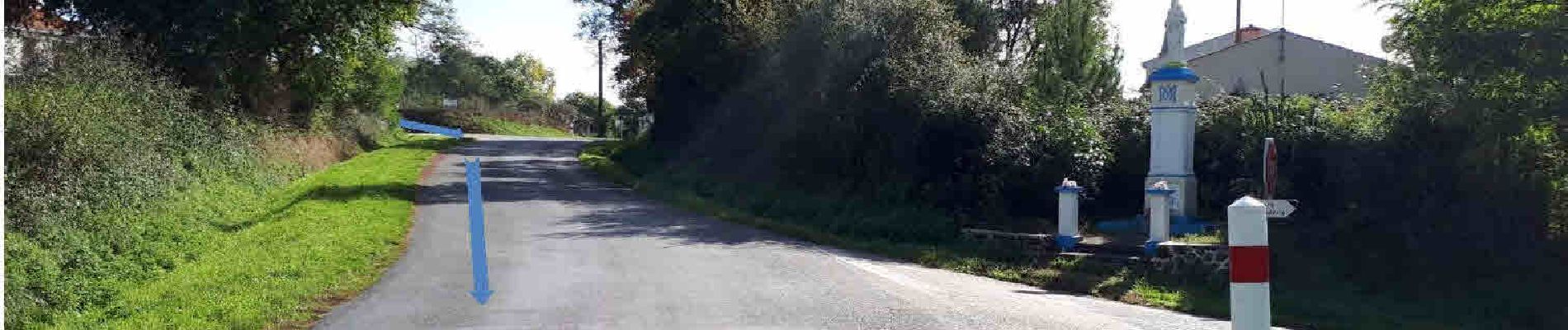
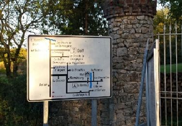
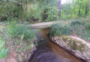
Trail Equestrian of 22 km to be discovered at Pays de la Loire, Vendée, Rives-de-l'Yon. This trail is proposed by clbolb7.
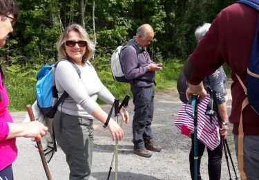
Elevation profile

Photos

Points of interest

Point of interest Rives-de-l'Yon - 5 Km - Photo
clbolb7
RIVES-DE-L'YON 
Point of interest Rives-de-l'Yon - A1-Parking - Photo
clbolb7
RIVES-DE-L'YON 
Point of interest Rives-de-l'Yon - S1-La Rabotière - Photo
clbolb7
RIVES-DE-L'YON 
Point of interest Rives-de-l'Yon - S2-La Gatine   km10 - Photo
clbolb7
RIVES-DE-L'YON 
Point of interest Rives-de-l'Yon - S3-Le tablier   km 12.5 - Photo
clbolb7
RIVES-DE-L'YON 
Point of interest Rives-de-l'Yon - A2-Parking - Photo
clbolb7
RIVES-DE-L'YON 
Point of interest Le Tablier - 15 Km - Photo
clbolb7
LE TABLIER 
Point of interest Rives-de-l'Yon - A4 - Photo
clbolb7
RIVES-DE-L'YON 
Point of interest Nesmy - 20 Km - Photo
clbolb7
NESMY 
Point of interest Rives-de-l'Yon - 30 Km - Photo
clbolb7
RIVES-DE-L'YON 

Positioning

Country:
France
Region :
Pays de la Loire
Department/Province :
Vendée
Municipality :
Rives-de-l'Yon
Location:
Chaillé-sous-les-Ormeaux
Start:(UTM)
623179 ; 5161013 (30T) N.

Trails nearby

Trail Walking Rives-de-l'Yon - caille les orneaux - Photo
Walking
penaud

Walking

Very easy
(1)
Rives-de-l'Yon, Pays de la Loire, Vendée, France
10.3 km | 12.3 km-effort
4h 25min
Yes
Trail Walking Le Tablier - la vallée de l'Yon 9 - Photo
Walking
cath310

Walking

Very easy
(1)
Le Tablier, Pays de la Loire, Vendée, France
16.2 km | 19.1 km-effort
4h 9min
Yes
Trail Walking Nesmy - Pays de l'Yon & Vie N°9 - Photo
Walking
cath310

Walking

Easy
(1)
Nesmy, Pays de la Loire, Vendée, France
10.9 km | 12.1 km-effort
2h 39min
Yes
Trail Walking Rives-de-l'Yon - Chaillé sous  les Orrmeaux - Photo
Walking
Gascon

Walking

Easy
(1)
Rives-de-l'Yon, Pays de la Loire, Vendée, France
16.6 km | 19.2 km-effort
4h 11min
Yes
Trail Walking Aubigny-Les Clouzeaux - AUBIGNY  - Photo
Walking
0010Jacem.1957

Walking

Very easy
Aubigny-Les Clouzeaux, Pays de la Loire, Vendée, France
22 km | 25 km-effort
6h 18min
No
Trail On foot Nesmy - L'Aulne...au fil de l'eau NESMY (sentier n°45 vendée rando FFR)  - Photo
On foot
cath310

On foot

Easy
Nesmy, Pays de la Loire, Vendée, France
10.5 km | 11.7 km-effort
2h 39min
Yes
Trail On foot Le Tablier - LA VALLEE DE L'YON n°9 sentiers Chamina  - Photo
On foot
cath310

On foot

Easy
Le Tablier, Pays de la Loire, Vendée, France
16.7 km | 19.7 km-effort
4h 28min
Yes
Trail Trail Rives-de-l'Yon - Boutet - Photo
Trail
arzoulc

Trail

Easy
Rives-de-l'Yon, Pays de la Loire, Vendée, France
7.9 km | 9.1 km-effort
59min
Yes
Trail On foot Aubigny-Les Clouzeaux - SENTIER DE LA PIERRE PLATE ET DU CHËNE - Photo
On foot
Jacquot85

On foot

Very easy
Aubigny-Les Clouzeaux, Pays de la Loire, Vendée, France
26 km | 29 km-effort
Unknown
Yes


Close
My subscriptions