


poleymieux

ppn
User

Length
8.2 km

Max alt
560 m

Uphill gradient
315 m
Km-Effort
12.4 km

Min alt
357 m

Downhill gradient
321 m
Boucle
Yes
Creation date :
2019-09-06 06:53:38.478
Updated on :
2019-09-06 09:36:13.974
2h42
Difficulty : Very easy

FREE GPS app for hiking
 SityTrail
IGN / Geographical institutes
SityTrail Plus
The world is yours!
About
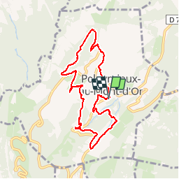
Trail Walking of 8.2 km to be discovered at Auvergne-Rhône-Alpes, Métropole de Lyon, Poleymieux-au-Mont-d'Or. This trail is proposed by ppn.
Positioning
Country:
France
Region :
Auvergne-Rhône-Alpes
Department/Province :
Métropole de Lyon
Municipality :
Poleymieux-au-Mont-d'Or
Location:
Unknown
Start:(Dec)
Start:(UTM)
639715 ; 5079398 (31T) N.
Comments