


Banc sous bois-Maintenon

A-M Lubin
User

Length
2.2 km

Max alt
667 m

Uphill gradient
11 m
Km-Effort
2.7 km

Min alt
556 m

Downhill gradient
117 m
Boucle
No
Creation date :
2019-09-06 12:30:10.422
Updated on :
2019-09-06 13:27:38.233
41m
Difficulty : Very easy

FREE GPS app for hiking
 SityTrail
IGN / Geographical institutes
SityTrail Plus
The world is yours!
About
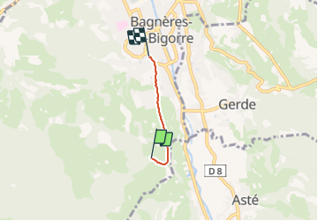
Trail Walking of 2.2 km to be discovered at Occitania, Hautespyrenees, Bagnères-de-Bigorre. This trail is proposed by A-M Lubin.
Positioning
Country:
France
Region :
Occitania
Department/Province :
Hautespyrenees
Municipality :
Bagnères-de-Bigorre
Location:
Unknown
Start:(Dec)
Start:(UTM)
267972 ; 4770031 (31T) N.
Comments