


nistos Nestea fait G4

LouisROGER
User GUIDE
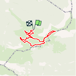

Length
7.4 km

Max alt
1726 m

Uphill gradient
212 m
Km-Effort
10.2 km

Min alt
1585 m

Downhill gradient
212 m
Boucle
Yes
Creation date :
2019-09-06 08:19:08.524
Updated on :
2019-09-06 15:11:44.288
4h21
Difficulty : Very easy

FREE GPS app for hiking
 SityTrail
IGN / Geographical institutes
SityTrail Plus
The world is yours!
About
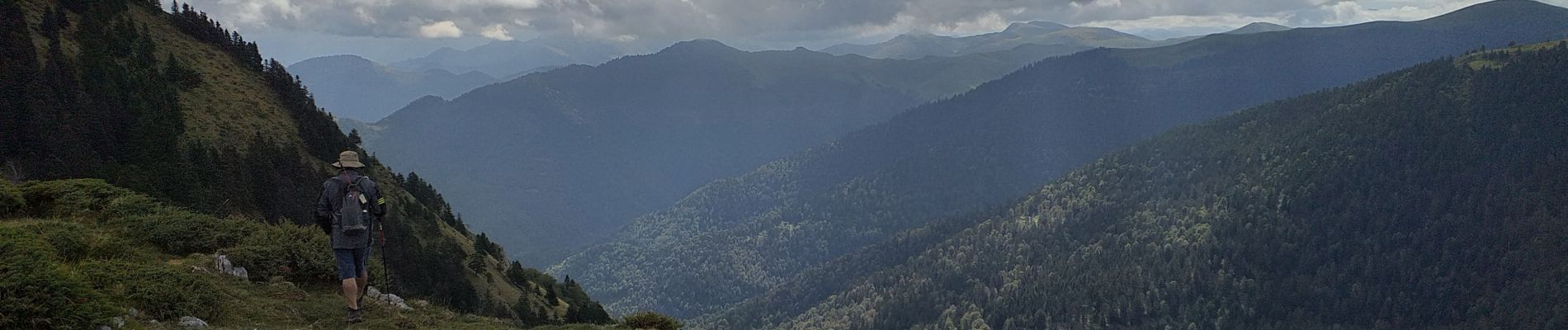
Trail Walking of 7.4 km to be discovered at Occitania, Hautespyrenees, Sarrancolin. This trail is proposed by LouisROGER.
Photos


Positioning
Country:
France
Region :
Occitania
Department/Province :
Hautespyrenees
Municipality :
Sarrancolin
Location:
Unknown
Start:(Dec)
Start:(UTM)
292519 ; 4757762 (31T) N.
Comments