


Autour de Montrieux (Belgentier)

frizou83
User
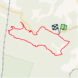

Length
8.8 km

Max alt
443 m

Uphill gradient
240 m
Km-Effort
12 km

Min alt
233 m

Downhill gradient
241 m
Boucle
Yes
Creation date :
2019-09-08 17:47:01.013
Updated on :
2019-09-08 17:48:31.621
2h32
Difficulty : Easy

FREE GPS app for hiking
 SityTrail
IGN / Geographical institutes
SityTrail Plus
The world is yours!
About
Trail Walking of 8.8 km to be discovered at Provence-Alpes-Côte d'Azur, Var, Méounes-lès-Montrieux. This trail is proposed by frizou83.
Positioning
Country:
France
Region :
Provence-Alpes-Côte d'Azur
Department/Province :
Var
Municipality :
Méounes-lès-Montrieux
Location:
Unknown
Start:(Dec)
Start:(UTM)
740529 ; 4794367 (31T) N.
Comments