


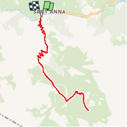
ITALIE bellino Sainte Anne. colle Sagneres

RobinMicheline
User GUIDE

Length
10.1 km

Max alt
2458 m

Uphill gradient
610 m
Km-Effort
18.3 km

Min alt
1846 m

Downhill gradient
612 m
Boucle
Yes
Creation date :
2019-09-09 07:10:27.101
Updated on :
2019-10-21 15:50:53.018
4h56
Difficulty : Difficult

FREE GPS app for hiking
 SityTrail
IGN / Geographical institutes
SityTrail Plus
The world is yours!
About
Trail Walking of 10.1 km to be discovered at Piemont, Cuneo, Bellino. This trail is proposed by RobinMicheline.
Description
11 kms 4 h 650 M dénivelé magnifique
Positioning
Country:
Italy
Region :
Piemont
Department/Province :
Cuneo
Municipality :
Bellino
Location:
Unknown
Start:(Dec)
Start:(UTM)
339072 ; 4937538 (32T) N.
Comments