


Chateau de la Viere depart Montjay

claude nier
User
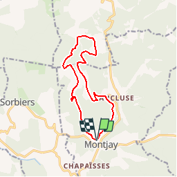

Length
13.2 km

Max alt
1142 m

Uphill gradient
450 m
Km-Effort
19.2 km

Min alt
830 m

Downhill gradient
439 m
Boucle
Yes
Creation date :
2019-09-10 09:39:04.02
Updated on :
2019-09-10 09:41:11.234
--
Difficulty : Medium

FREE GPS app for hiking
 SityTrail
IGN / Geographical institutes
SityTrail Plus
The world is yours!
About
Trail On foot of 13.2 km to be discovered at Provence-Alpes-Côte d'Azur, Hautes-Alpes, Montjay. This trail is proposed by claude nier.
Description
belle rando a faire.....
Positioning
Country:
France
Region :
Provence-Alpes-Côte d'Azur
Department/Province :
Hautes-Alpes
Municipality :
Montjay
Location:
Unknown
Start:(Dec)
Start:(UTM)
707484 ; 4915327 (31T) N.
Comments