


Cascades de Doumblas, lacs de Remoulis

pacha56
User
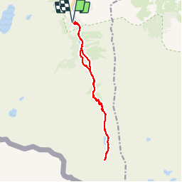

Length
15.5 km

Max alt
2124 m

Uphill gradient
702 m
Km-Effort
25 km

Min alt
1476 m

Downhill gradient
703 m
Boucle
Yes
Creation date :
2019-09-11 09:07:20.734
Updated on :
2019-09-11 14:51:50.816
5h23
Difficulty : Medium

FREE GPS app for hiking
 SityTrail
IGN / Geographical institutes
SityTrail Plus
The world is yours!
About
Trail Walking of 15.5 km to be discovered at Occitania, Hautespyrenees, Arrens-Marsous. This trail is proposed by pacha56.
Description
Départ dans une belle forêt, puis des lacs, un peu de pierriers
Positioning
Country:
France
Region :
Occitania
Department/Province :
Hautespyrenees
Municipality :
Arrens-Marsous
Location:
Unknown
Start:(Dec)
Start:(UTM)
722882 ; 4751454 (30T) N.
Comments