


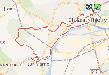
Château-Thierry - la Côte 204

VANDERPUTTENMi
User GUIDE

Length
10.4 km

Max alt
210 m

Uphill gradient
209 m
Km-Effort
13.2 km

Min alt
57 m

Downhill gradient
208 m
Boucle
Yes
Creation date :
2019-09-11 11:55:53.745
Updated on :
2020-11-15 12:21:17.176
3h17
Difficulty : Easy

FREE GPS app for hiking
 SityTrail
IGN / Geographical institutes
SityTrail Plus
The world is yours!
About
Trail Walking of 10.4 km to be discovered at Hauts-de-France, Aisne, Château-Thierry. This trail is proposed by VANDERPUTTENMi.
Photos


Positioning
Country:
France
Region :
Hauts-de-France
Department/Province :
Aisne
Municipality :
Château-Thierry
Location:
Unknown
Start:(Dec)
Start:(UTM)
529654 ; 5432902 (31U) N.
Comments