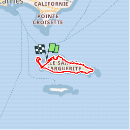
iles de Lerins

Renefrt
User

Length
10 km

Max alt
36 m

Uphill gradient
141 m
Km-Effort
11.9 km

Min alt
0 m

Downhill gradient
133 m
Boucle
Yes
Creation date :
2019-09-12 07:55:41.052
Updated on :
2019-09-12 13:24:46.705
5h27
Difficulty : Very easy

FREE GPS app for hiking
 SityTrail
IGN / Geographical institutes
SityTrail Plus
The world is yours!
About
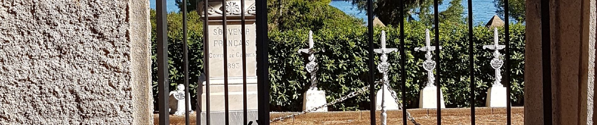
Trail Walking of 10 km to be discovered at Provence-Alpes-Côte d'Azur, Maritime Alps, Cannes. This trail is proposed by Renefrt.
Photos


Positioning
Country:
France
Region :
Provence-Alpes-Côte d'Azur
Department/Province :
Maritime Alps
Municipality :
Cannes
Location:
Unknown
Start:(Dec)
Start:(UTM)
341493 ; 4820716 (32T) N.
Comments