


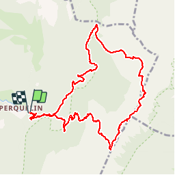
CHARTREUSE Rocher de Bellefond - Col de la Saulce

JMHRX2
User

Length
11.4 km

Max alt
1910 m

Uphill gradient
980 m
Km-Effort
24 km

Min alt
997 m

Downhill gradient
983 m
Boucle
Yes
Creation date :
2019-09-14 08:54:59.146
Updated on :
2019-09-14 19:14:54.856
4h16
Difficulty : Very easy

FREE GPS app for hiking
 SityTrail
IGN / Geographical institutes
SityTrail Plus
The world is yours!
About
Trail Walking of 11.4 km to be discovered at Auvergne-Rhône-Alpes, Isère, Saint-Pierre-de-Chartreuse. This trail is proposed by JMHRX2.
Positioning
Country:
France
Region :
Auvergne-Rhône-Alpes
Department/Province :
Isère
Municipality :
Saint-Pierre-de-Chartreuse
Location:
Unknown
Start:(Dec)
Start:(UTM)
723163 ; 5023698 (31T) N.
Comments