


pas du fourneau

oliviergau
User
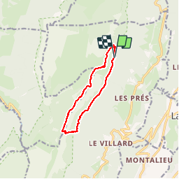

Length
9.8 km

Max alt
1819 m

Uphill gradient
654 m
Km-Effort
18.5 km

Min alt
1246 m

Downhill gradient
658 m
Boucle
Yes
Creation date :
2019-09-15 07:56:35.823
Updated on :
2019-09-15 13:23:17.331
5h02
Difficulty : Very easy

FREE GPS app for hiking
 SityTrail
IGN / Geographical institutes
SityTrail Plus
The world is yours!
About
Trail Walking of 9.8 km to be discovered at Auvergne-Rhône-Alpes, Isère, Sainte-Marie-du-Mont. This trail is proposed by oliviergau.
Positioning
Country:
France
Region :
Auvergne-Rhône-Alpes
Department/Province :
Isère
Municipality :
Sainte-Marie-du-Mont
Location:
Unknown
Start:(Dec)
Start:(UTM)
729826 ; 5033918 (31T) N.
Comments