


Col de Moulata, lac d'Isaby

pacha56
User
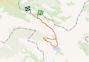

Length
6.6 km

Max alt
1678 m

Uphill gradient
170 m
Km-Effort
8.8 km

Min alt
1523 m

Downhill gradient
168 m
Boucle
No
Creation date :
2019-09-15 11:20:56.082
Updated on :
2019-09-15 18:14:50.34
3h08
Difficulty : Very easy

FREE GPS app for hiking
 SityTrail
IGN / Geographical institutes
SityTrail Plus
The world is yours!
About
Trail Walking of 6.6 km to be discovered at Occitania, Hautespyrenees, Beaucens. This trail is proposed by pacha56.
Description
Ballade tranquille en famille, très beaux paysages..
Positioning
Country:
France
Region :
Occitania
Department/Province :
Hautespyrenees
Municipality :
Beaucens
Location:
Unknown
Start:(Dec)
Start:(UTM)
256192 ; 4761439 (31T) N.
Comments
Attention, pour le retour après le lac, un gué est à traverser, ensuite une partie se fait en terrain non balisé . Bien suivre la trace Gpx.