


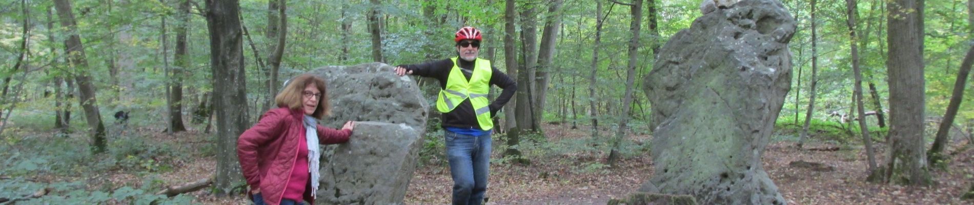
halte menhirs d' iderolles

gilbertdu60
User

Length
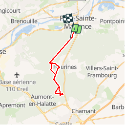
17.1 km

Max alt
129 m

Uphill gradient
166 m
Km-Effort
19.4 km

Min alt
92 m

Downhill gradient
183 m
Boucle
No
Creation date :
2019-09-18 14:11:58.273
Updated on :
2019-10-16 12:15:08.693
1h59
Difficulty : Easy

FREE GPS app for hiking
 SityTrail
IGN / Geographical institutes
SityTrail Plus
The world is yours!
About
Trail Hybrid bike of 17.1 km to be discovered at Hauts-de-France, Oise, Pont-Sainte-Maxence. This trail is proposed by gilbertdu60.
Description
balade en forêt d'halatte des terriers au menhirs d'iderolles
Photos


Positioning
Country:
France
Region :
Hauts-de-France
Department/Province :
Oise
Municipality :
Pont-Sainte-Maxence
Location:
Unknown
Start:(Dec)
Start:(UTM)
470436 ; 5459201 (31U) N.
Comments