


Tour ile de houat

harydh
User GUIDE
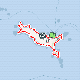

Length
17.9 km

Max alt
31 m

Uphill gradient
184 m
Km-Effort
20 km

Min alt
0 m

Downhill gradient
184 m
Boucle
Yes
Creation date :
2019-09-20 06:57:39.8
Updated on :
2019-09-20 14:06:44.415
7h07
Difficulty : Easy

FREE GPS app for hiking
 SityTrail
IGN / Geographical institutes
SityTrail Plus
The world is yours!
About
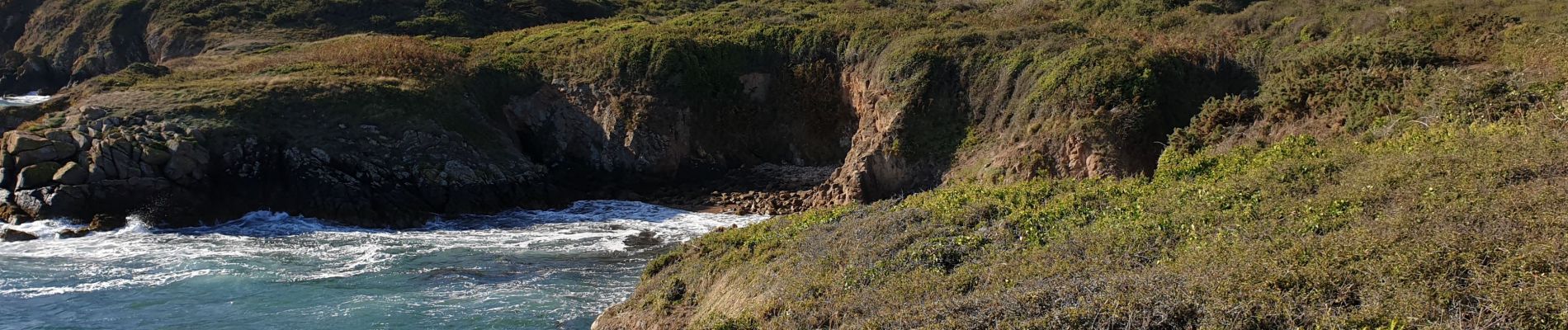
Trail Walking of 17.9 km to be discovered at Brittany, Morbihan, Île-d'Houat. This trail is proposed by harydh.
Photos


Positioning
Country:
France
Region :
Brittany
Department/Province :
Morbihan
Municipality :
Île-d'Houat
Location:
Unknown
Start:(Dec)
Start:(UTM)
502933 ; 5248170 (30T) N.
Comments