


Pas des Bachassons. La Batie

ezorzet
User
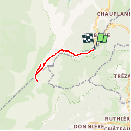

Length
11.4 km

Max alt
1956 m

Uphill gradient
871 m
Km-Effort
23 km

Min alt
1131 m

Downhill gradient
871 m
Boucle
Yes
Creation date :
2019-09-21 06:05:33.913
Updated on :
2019-09-21 15:37:12.422
6h06
Difficulty : Medium

FREE GPS app for hiking
 SityTrail
IGN / Geographical institutes
SityTrail Plus
The world is yours!
About
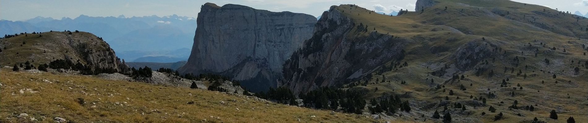
Trail Walking of 11.4 km to be discovered at Auvergne-Rhône-Alpes, Isère, Saint-Michel-les-Portes. This trail is proposed by ezorzet.
Description
Magnifique randonnée un peu hard à l'arrivée.
Photos


Positioning
Country:
France
Region :
Auvergne-Rhône-Alpes
Department/Province :
Isère
Municipality :
Saint-Michel-les-Portes
Location:
Unknown
Start:(Dec)
Start:(UTM)
702080 ; 4970350 (31T) N.
Comments