


retour sous l'aiguille.

clozelmarie
User
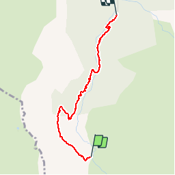

Length
2.5 km

Max alt
1564 m

Uphill gradient
0 m
Km-Effort
3.7 km

Min alt
1190 m

Downhill gradient
359 m
Boucle
No
Creation date :
2019-09-21 12:06:46.349
Updated on :
2019-09-21 16:35:55.301
1h06
Difficulty : Very easy

FREE GPS app for hiking
 SityTrail
IGN / Geographical institutes
SityTrail Plus
The world is yours!
About
Trail Walking of 2.5 km to be discovered at Auvergne-Rhône-Alpes, Upper Savoy, Manigod. This trail is proposed by clozelmarie.
Positioning
Country:
France
Region :
Auvergne-Rhône-Alpes
Department/Province :
Upper Savoy
Municipality :
Manigod
Location:
Unknown
Start:(Dec)
Start:(UTM)
299124 ; 5077072 (32T) N.
Comments