


flagnac numero 2

louis46
User
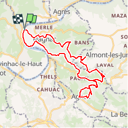

Length
20 km

Max alt
404 m

Uphill gradient
657 m
Km-Effort
29 km

Min alt
182 m

Downhill gradient
654 m
Boucle
Yes
Creation date :
2019-09-23 07:29:02.703
Updated on :
2019-09-23 07:30:46.68
--
Difficulty : Very easy

FREE GPS app for hiking
 SityTrail
IGN / Geographical institutes
SityTrail Plus
The world is yours!
About
Trail On foot of 20 km to be discovered at Occitania, Aveyron, Flagnac. This trail is proposed by louis46.
Positioning
Country:
France
Region :
Occitania
Department/Province :
Aveyron
Municipality :
Flagnac
Location:
Unknown
Start:(Dec)
Start:(UTM)
439207 ; 4939688 (31T) N.
Comments