


Commeny - L'eau et le pain

marcel.F
User

Length
13.2 km

Max alt
113 m

Uphill gradient
139 m
Km-Effort
15.1 km

Min alt
54 m

Downhill gradient
139 m
Boucle
Yes
Creation date :
2014-12-10 00:00:00.0
Updated on :
2014-12-10 00:00:00.0
3h18
Difficulty : Easy

FREE GPS app for hiking
 SityTrail
IGN / Geographical institutes
SityTrail Plus
The world is yours!
About
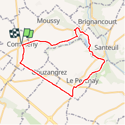
Trail Walking of 13.2 km to be discovered at Ile-de-France, Val-d'Oise, Commeny. This trail is proposed by marcel.F.
Description
Boucle au départ du parking rue principale de Commeny.
Maison du pain à Commeny
Positioning
Country:
France
Region :
Ile-de-France
Department/Province :
Val-d'Oise
Municipality :
Commeny
Location:
Unknown
Start:(Dec)
Start:(UTM)
419043 ; 5442160 (31U) N.
Comments
balade sympa dans le Vexin profond...