


20190930Pernes les fontaines

Jeanclaudebic
User

Length
4.3 km

Max alt
96 m

Uphill gradient
41 m
Km-Effort
4.8 km

Min alt
79 m

Downhill gradient
33 m
Boucle
No
Creation date :
2019-09-30 13:49:35.46
Updated on :
2019-09-30 16:25:37.559
2h35
Difficulty : Very easy

FREE GPS app for hiking
 SityTrail
IGN / Geographical institutes
SityTrail Plus
The world is yours!
About
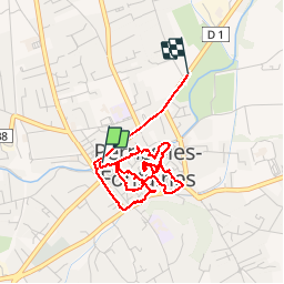
Trail Walking of 4.3 km to be discovered at Provence-Alpes-Côte d'Azur, Vaucluse, Pernes-les-Fontaines. This trail is proposed by Jeanclaudebic.
Positioning
Country:
France
Region :
Provence-Alpes-Côte d'Azur
Department/Province :
Vaucluse
Municipality :
Pernes-les-Fontaines
Location:
Unknown
Start:(Dec)
Start:(UTM)
664822 ; 4873778 (31T) N.
Comments