


Salernes

ETMU5496
User
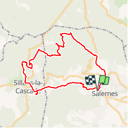

Length
18.4 km

Max alt
481 m

Uphill gradient
397 m
Km-Effort
24 km

Min alt
218 m

Downhill gradient
397 m
Boucle
Yes
Creation date :
2019-10-02 07:06:40.0
Updated on :
2019-10-05 08:42:00.008
5h14
Difficulty : Medium

FREE GPS app for hiking
 SityTrail
IGN / Geographical institutes
SityTrail Plus
The world is yours!
About
Trail Walking of 18.4 km to be discovered at Provence-Alpes-Côte d'Azur, Var, Salernes. This trail is proposed by ETMU5496.
Description
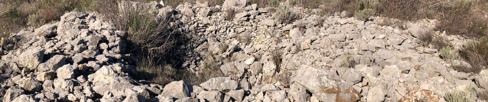
Randonnée tranquille au départ de Salernes, traversant un site mégalithique datant de -2500 ans avant JC. Puis continuation par un parcours ombragé jusqu'à Sillans la Cascade.
Puis retour à Salernes
Photos


Positioning
Country:
France
Region :
Provence-Alpes-Côte d'Azur
Department/Province :
Var
Municipality :
Salernes
Location:
Unknown
Start:(Dec)
Start:(UTM)
276074 ; 4827319 (32T) N.
Comments