


Île Ste Marguerite

dan69390
User
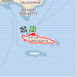

Length
11.3 km

Max alt
38 m

Uphill gradient
236 m
Km-Effort
14.5 km

Min alt
-1 m

Downhill gradient
232 m
Boucle
Yes
Creation date :
2019-10-03 08:21:20.0
Updated on :
2019-10-03 13:15:59.834
4h53
Difficulty : Medium

FREE GPS app for hiking
 SityTrail
IGN / Geographical institutes
SityTrail Plus
The world is yours!
About
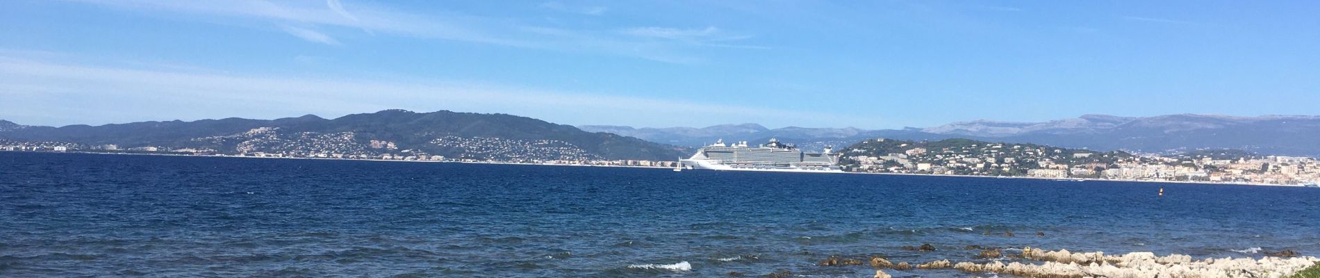
Trail Walking of 11.3 km to be discovered at Provence-Alpes-Côte d'Azur, Maritime Alps, Cannes. This trail is proposed by dan69390.
Photos

Positioning
Country:
France
Region :
Provence-Alpes-Côte d'Azur
Department/Province :
Maritime Alps
Municipality :
Cannes
Location:
Unknown
Start:(Dec)
Start:(UTM)
341559 ; 4820676 (32T) N.
Comments