


lanchatra

Liebeaux
User
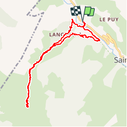

Length
10.9 km

Max alt
1811 m

Uphill gradient
710 m
Km-Effort
20 km

Min alt
1187 m

Downhill gradient
711 m
Boucle
Yes
Creation date :
2019-10-03 06:42:05.136
Updated on :
2019-10-03 13:19:25.329
6h35
Difficulty : Very easy

FREE GPS app for hiking
 SityTrail
IGN / Geographical institutes
SityTrail Plus
The world is yours!
About
Trail Walking of 10.9 km to be discovered at Auvergne-Rhône-Alpes, Isère, Saint-Christophe-en-Oisans. This trail is proposed by Liebeaux.
Positioning
Country:
France
Region :
Auvergne-Rhône-Alpes
Department/Province :
Isère
Municipality :
Saint-Christophe-en-Oisans
Location:
Unknown
Start:(Dec)
Start:(UTM)
275649 ; 4983334 (32T) N.
Comments