


Autour du crêt de Chazay

gilder89
User

Length
15.7 km

Max alt
904 m

Uphill gradient
558 m
Km-Effort
23 km

Min alt
532 m

Downhill gradient
557 m
Boucle
Yes
Creation date :
2019-10-03 16:31:33.486
Updated on :
2019-10-03 16:49:54.268
2h30
Difficulty : Medium

FREE GPS app for hiking
 SityTrail
IGN / Geographical institutes
SityTrail Plus
The world is yours!
About
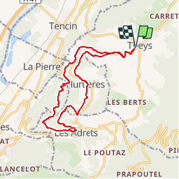
Trail Mountain bike of 15.7 km to be discovered at Auvergne-Rhône-Alpes, Isère, Theys. This trail is proposed by gilder89.
Description
Randonnée VTT au départ de Theys direction les Adrets. Début et fin sur route mais entre temps de nombreux sentie agréables et de beaux points de vue.
Positioning
Country:
France
Region :
Auvergne-Rhône-Alpes
Department/Province :
Isère
Municipality :
Theys
Location:
Unknown
Start:(Dec)
Start:(UTM)
734696 ; 5020680 (31T) N.
Comments