


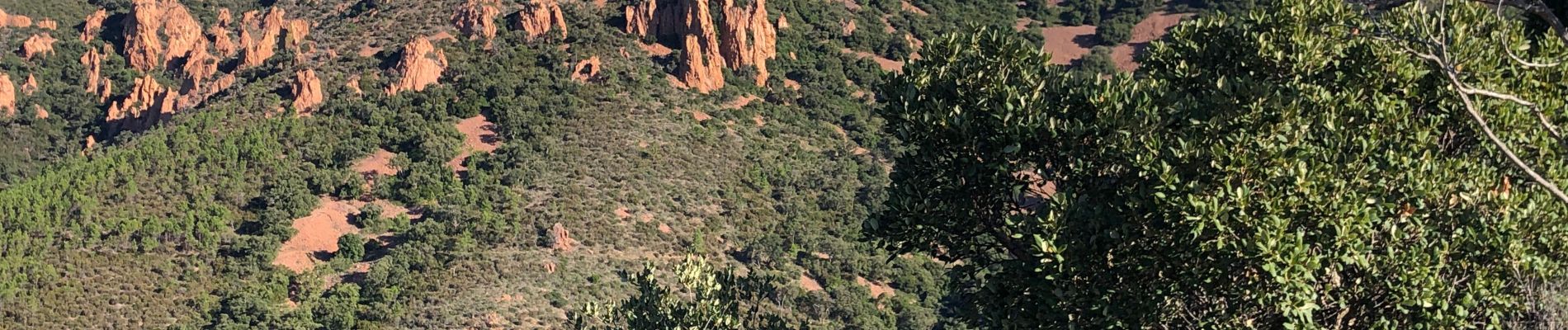
Pic de l’Ours - Col de la Cadière - ancien Lac de l'Ecureuil

JPL8321
User
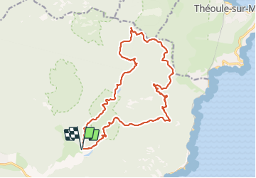

Length
22 km

Max alt
486 m

Uphill gradient
706 m
Km-Effort
31 km

Min alt
28 m

Downhill gradient
705 m
Boucle
Yes
Creation date :
2019-10-04 06:26:08.0
Updated on :
2019-10-04 16:45:24.337
6h53
Difficulty : Very difficult

FREE GPS app for hiking
 SityTrail
IGN / Geographical institutes
SityTrail Plus
The world is yours!
About
Trail Walking of 22 km to be discovered at Provence-Alpes-Côte d'Azur, Var, Saint-Raphaël. This trail is proposed by JPL8321.
Photos


Positioning
Country:
France
Region :
Provence-Alpes-Côte d'Azur
Department/Province :
Var
Municipality :
Saint-Raphaël
Location:
Unknown
Start:(Dec)
Start:(UTM)
327568 ; 4813724 (32T) N.
Comments