


Rocher de Beaumont depart Arlaud

claude nier
User
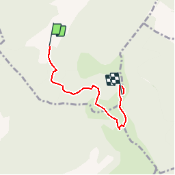

Length
4.3 km

Max alt
1524 m

Uphill gradient
699 m
Km-Effort
11.4 km

Min alt
866 m

Downhill gradient
54 m
Boucle
No
Creation date :
2019-10-04 16:53:48.415
Updated on :
2019-10-04 16:54:49.09
--
Difficulty : Difficult

FREE GPS app for hiking
 SityTrail
IGN / Geographical institutes
SityTrail Plus
The world is yours!
About
Trail On foot of 4.3 km to be discovered at Provence-Alpes-Côte d'Azur, Hautes-Alpes, Montclus. This trail is proposed by claude nier.
Description
pas mal....
Positioning
Country:
France
Region :
Provence-Alpes-Côte d'Azur
Department/Province :
Hautes-Alpes
Municipality :
Montclus
Location:
Unknown
Start:(Dec)
Start:(UTM)
712431 ; 4919112 (31T) N.
Comments