


Rocher de Beaumont depart Serres

claude nier
User
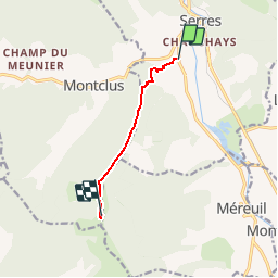

Length
5.3 km

Max alt
1523 m

Uphill gradient
870 m
Km-Effort
14 km

Min alt
655 m

Downhill gradient
3 m
Boucle
No
Creation date :
2019-10-04 17:00:06.359
Updated on :
2019-10-04 17:01:04.211
--
Difficulty : Difficult

FREE GPS app for hiking
 SityTrail
IGN / Geographical institutes
SityTrail Plus
The world is yours!
About
Trail On foot of 5.3 km to be discovered at Provence-Alpes-Côte d'Azur, Hautes-Alpes, Serres. This trail is proposed by claude nier.
Description
pas mal ....
Positioning
Country:
France
Region :
Provence-Alpes-Côte d'Azur
Department/Province :
Hautes-Alpes
Municipality :
Serres
Location:
Unknown
Start:(Dec)
Start:(UTM)
715706 ; 4922171 (31T) N.
Comments