


Venelles - Fontaine des Tuiles - Tour de César

mhetpierre
User
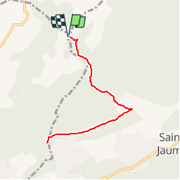

Length
8.3 km

Max alt
433 m

Uphill gradient
83 m
Km-Effort
9.4 km

Min alt
410 m

Downhill gradient
82 m
Boucle
Yes
Creation date :
2019-10-05 16:47:26.214
Updated on :
2019-10-05 16:48:15.243
--
Difficulty : Very easy

FREE GPS app for hiking
 SityTrail
IGN / Geographical institutes
SityTrail Plus
The world is yours!
About
Trail On foot of 8.3 km to be discovered at Provence-Alpes-Côte d'Azur, Bouches-du-Rhône, Saint-Marc-Jaumegarde. This trail is proposed by mhetpierre.
Positioning
Country:
France
Region :
Provence-Alpes-Côte d'Azur
Department/Province :
Bouches-du-Rhône
Municipality :
Saint-Marc-Jaumegarde
Location:
Unknown
Start:(Dec)
Start:(UTM)
701383 ; 4826716 (31T) N.
Comments