


Pas de la Mine en circuit

Emelle
User
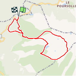

Length
9.8 km

Max alt
2446 m

Uphill gradient
790 m
Km-Effort
20 km

Min alt
1680 m

Downhill gradient
790 m
Boucle
Yes
Creation date :
2019-10-06 06:38:58.762
Updated on :
2019-10-06 14:12:44.944
6h38
Difficulty : Medium

FREE GPS app for hiking
 SityTrail
IGN / Geographical institutes
SityTrail Plus
The world is yours!
About
Trail Walking of 9.8 km to be discovered at Auvergne-Rhône-Alpes, Isère, Livet-et-Gavet. This trail is proposed by Emelle.
Description
Une partie non balisés sur sentier passant par le pas de la Vache puis le lac du Brouffier
Positioning
Country:
France
Region :
Auvergne-Rhône-Alpes
Department/Province :
Isère
Municipality :
Livet-et-Gavet
Location:
Unknown
Start:(Dec)
Start:(UTM)
726233 ; 4992183 (31T) N.
Comments