Trail On foot Oberwolfach - Circuit Kreussattel - Brandenbourg en Allemagne - Photo

Circuit Kreussattel - Brandenbourg en Allemagne

 Luster
Luster

User

© OpenStreetMap contributors
Length
Length
6.1 km
Max alt
Max alt
956 m
Uphill gradient
Uphill gradient
239 m
Km-Effort
Km-Effort  
9.3 km
Min alt
Min alt
741 m
Downhill gradient
Downhill gradient
241 m
Boucle
Boucle
Yes
Creation date :
2019-10-10 01:40:29.642
Updated on :
2019-10-10 02:09:48.099

(0 Reviews)

On foot
On foot
2h30
Difficulty : Easy

Scan this QR Code to open this trail in the SityTrail application

FREE GPS app for hiking

Logo SityTrail SityTrail

IGN / Geographical institutes

Download SityTrail from the App Store Download SityTrail from Google Play

Logo SityTrail SityTrail World

The world is yours!

Download SityTrail from the App Store Download SityTrail from Google Play Download SityTrail on Huawei AppGallery

About

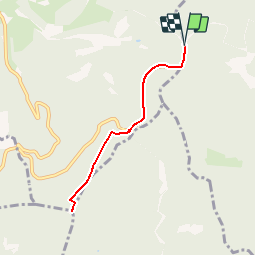
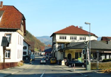
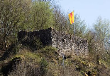
Trail On foot of 6.1 km to be discovered at Baden-Württemberg, Ortenaukreis, Oberwolfach. This trail is proposed by Luster.

Description

Longueur 6,1 km  km-effort 8,5 km, altitude max 956 m et mini 741 donc un dénivelé de 239 m. Au Brandenkopf il y a un restaurant ou l'on peut se restaurer à un prix raisonnable.

Elevation profile

Positioning

Country:
Germany
Region :
Baden-Württemberg
Department/Province :
Ortenaukreis
Municipality :
Oberwolfach
Location:
Unknown
Start:(UTM)
438774 ; 5356363 (32U) N.

Trails nearby

Trail On foot Oberharmersbach - Harmersbacher Vesperweg - Photo
On foot
PRO

On foot

Medium
Oberharmersbach, Baden-Württemberg, Ortenaukreis, Germany
14.3 km | 22 km-effort
4h 55min
Yes
Trail On foot Oberharmersbach - Riersbach - Hark - Photo
On foot
PRO

On foot

Easy
Oberharmersbach, Baden-Württemberg, Ortenaukreis, Germany
4.1 km | 8.1 km-effort
1h 50min
No
Trail On foot Oberharmersbach - Oberharmersbach - Kreuzsattel - Photo
On foot
PRO

On foot

Easy
Oberharmersbach, Baden-Württemberg, Ortenaukreis, Germany
4.7 km | 9.2 km-effort
2h 5min
No
Trail On foot Oberwolfach - Guck a mol Wegle - Photo
On foot
PRO

On foot

Easy
Oberwolfach, Baden-Württemberg, Ortenaukreis, Germany
12.3 km | 19.8 km-effort
4h 30min
Yes
Trail Other activity Oberharmersbach - ober - Photo
Other activity
bbizouerne

Other activity

Very easy
Oberharmersbach, Baden-Württemberg, Ortenaukreis, Germany
21 km | 32 km-effort
3h 46min
Yes
Trail Walking Oberharmersbach - foret noire - Photo
Walking
Pataltorf

Walking

Medium
Oberharmersbach, Baden-Württemberg, Ortenaukreis, Germany
15.5 km | 24 km-effort
6h 5min
Yes


Close
My subscriptions