


GIERRE . picouse .la grande gautiere o

RobinMicheline
User GUIDE
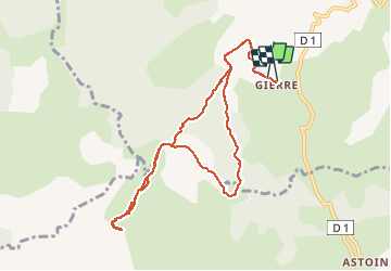

Length
10.4 km

Max alt
1809 m

Uphill gradient
688 m
Km-Effort
19.6 km

Min alt
1127 m

Downhill gradient
699 m
Boucle
Yes
Creation date :
2019-10-08 07:51:21.769
Updated on :
2020-01-22 19:19:00.107
6h11
Difficulty : Medium

FREE GPS app for hiking
 SityTrail
IGN / Geographical institutes
SityTrail Plus
The world is yours!
About
Trail Walking of 10.4 km to be discovered at Provence-Alpes-Côte d'Azur, Alpes-de-Haute-Provence, Turriers. This trail is proposed by RobinMicheline.
Description
montée et descente raide . au sommet vue à 360 degrés
Positioning
Country:
France
Region :
Provence-Alpes-Côte d'Azur
Department/Province :
Alpes-de-Haute-Provence
Municipality :
Turriers
Location:
Unknown
Start:(Dec)
Start:(UTM)
273561 ; 4918633 (32T) N.
Comments