


Vignols

newman
User
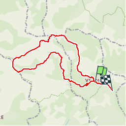

Length
17.4 km

Max alt
2791 m

Uphill gradient
1379 m
Km-Effort
36 km

Min alt
1546 m

Downhill gradient
1450 m
Boucle
No
Creation date :
2019-10-12 07:31:12.451
Updated on :
2019-10-12 15:44:26.873
6h50
Difficulty : Very easy

FREE GPS app for hiking
 SityTrail
IGN / Geographical institutes
SityTrail Plus
The world is yours!
About
Trail Walking of 17.4 km to be discovered at Provence-Alpes-Côte d'Azur, Maritime Alps, Roubion. This trail is proposed by newman.
Positioning
Country:
France
Region :
Provence-Alpes-Côte d'Azur
Department/Province :
Maritime Alps
Municipality :
Roubion
Location:
Unknown
Start:(Dec)
Start:(UTM)
340882 ; 4888981 (32T) N.
Comments