


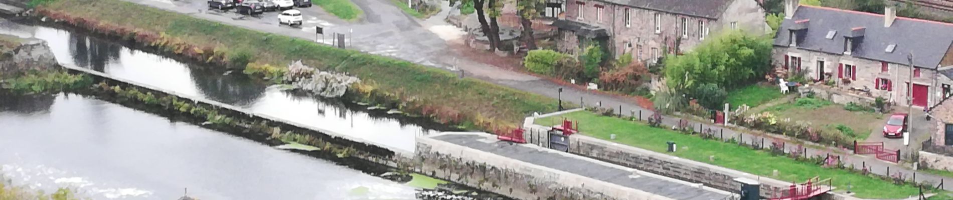
190913 Laillé le Boël

chasle
User
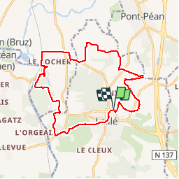

Length
17 km

Max alt
108 m

Uphill gradient
239 m
Km-Effort
20 km

Min alt
20 m

Downhill gradient
240 m
Boucle
Yes
Creation date :
2019-10-13 07:49:46.716
Updated on :
2019-10-13 17:17:09.746
4h46
Difficulty : Easy

FREE GPS app for hiking
 SityTrail
IGN / Geographical institutes
SityTrail Plus
The world is yours!
About
Trail Walking of 17 km to be discovered at Brittany, Ille-et-Vilaine, Laillé. This trail is proposed by chasle.
Photos


Positioning
Country:
France
Region :
Brittany
Department/Province :
Ille-et-Vilaine
Municipality :
Laillé
Location:
Unknown
Start:(Dec)
Start:(UTM)
595790 ; 5315137 (30T) N.
Comments