


Croix du Caire

ajd26
User
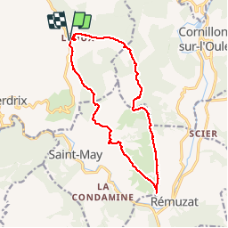

Length
15.2 km

Max alt
1041 m

Uphill gradient
689 m
Km-Effort
24 km

Min alt
645 m

Downhill gradient
689 m
Boucle
Yes
Creation date :
2019-10-13 07:19:28.0
Updated on :
2019-10-14 15:51:09.154
5h30
Difficulty : Medium

FREE GPS app for hiking
 SityTrail
IGN / Geographical institutes
SityTrail Plus
The world is yours!
About
Trail Walking of 15.2 km to be discovered at Auvergne-Rhône-Alpes, Drôme, Villeperdrix. This trail is proposed by ajd26.
Description
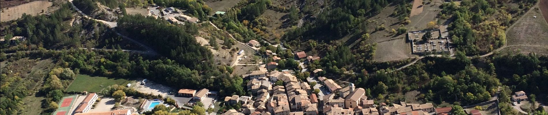
Départ de Leoux, col du Pensier, crêtes du plateau jusqu’à La Croix du Caire, panorama sur Remuza et retour par l’abbaye de Bodon. Pendant toute la rando, les vautours nous accompagnent
Photos

Positioning
Country:
France
Region :
Auvergne-Rhône-Alpes
Department/Province :
Drôme
Municipality :
Villeperdrix
Location:
Unknown
Start:(Dec)
Start:(UTM)
684210 ; 4925389 (31T) N.
Comments