cheverny ; les huards;les mezes

gerardh
User

Length
11.1 km

Max alt
106 m

Uphill gradient
79 m
Km-Effort
12.1 km

Min alt
75 m

Downhill gradient
80 m
Boucle
Yes
Creation date :
2019-10-15 15:06:44.765
Updated on :
2019-10-15 15:08:07.307
--
Difficulty : Very easy

FREE GPS app for hiking
 SityTrail
IGN / Geographical institutes
SityTrail Plus
The world is yours!
About
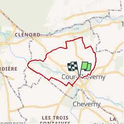
Trail On foot of 11.1 km to be discovered at Centre-Loire Valley, Loir-et-Cher, Cour-Cheverny. This trail is proposed by gerardh.
Positioning
Country:
France
Region :
Centre-Loire Valley
Department/Province :
Loir-et-Cher
Municipality :
Cour-Cheverny
Location:
Unknown
Start:(Dec)
Start:(UTM)
383754 ; 5263294 (31T) N.
Comments