


les terriers à senlis

gilbertdu60
User
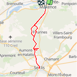

Length
26 km

Max alt
130 m

Uphill gradient
305 m
Km-Effort
30 km

Min alt
53 m

Downhill gradient
305 m
Boucle
Yes
Creation date :
2019-10-15 12:17:05.351
Updated on :
2019-10-16 12:10:52.535
2h40
Difficulty : Easy

FREE GPS app for hiking
 SityTrail
IGN / Geographical institutes
SityTrail Plus
The world is yours!
About
Trail Hybrid bike of 26 km to be discovered at Hauts-de-France, Oise, Pont-Sainte-Maxence. This trail is proposed by gilbertdu60.
Description
pont ste maxence senlis par le GR12
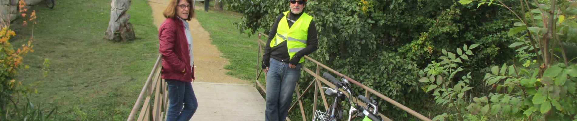
Photos


Positioning
Country:
France
Region :
Hauts-de-France
Department/Province :
Oise
Municipality :
Pont-Sainte-Maxence
Location:
Unknown
Start:(Dec)
Start:(UTM)
470850 ; 5460279 (31U) N.
Comments