Lac de pelouse

andre06130
User

Length
5.5 km

Max alt
2449 m

Uphill gradient
551 m
Km-Effort
11 km

Min alt
1895 m

Downhill gradient
3 m
Boucle
No
Creation date :
2014-12-10 00:00:00.0
Updated on :
2014-12-10 00:00:00.0
2h30
Difficulty : Medium

FREE GPS app for hiking
 SityTrail
IGN / Geographical institutes
SityTrail Plus
The world is yours!
About
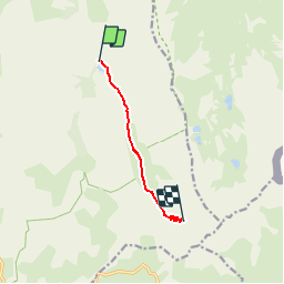
Trail Walking of 5.5 km to be discovered at Provence-Alpes-Côte d'Azur, Alpes-de-Haute-Provence, Jausiers. This trail is proposed by andre06130.
Positioning
Country:
France
Region :
Provence-Alpes-Côte d'Azur
Department/Province :
Alpes-de-Haute-Provence
Municipality :
Jausiers
Location:
Unknown
Start:(Dec)
Start:(UTM)
327335 ; 4917198 (32T) N.
Comments