


Col de terre blanche

andre06130
User
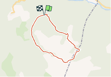

Length
6.8 km

Max alt
2253 m

Uphill gradient
673 m
Km-Effort
15.7 km

Min alt
1585 m

Downhill gradient
655 m
Boucle
Yes
Creation date :
2014-12-10 00:00:00.0
Updated on :
2014-12-10 00:00:00.0
3h07
Difficulty : Easy

FREE GPS app for hiking
 SityTrail
IGN / Geographical institutes
SityTrail Plus
The world is yours!
About
Trail Walking of 6.8 km to be discovered at Provence-Alpes-Côte d'Azur, Alpes-de-Haute-Provence, Méolans-Revel. This trail is proposed by andre06130.
Positioning
Country:
France
Region :
Provence-Alpes-Côte d'Azur
Department/Province :
Alpes-de-Haute-Provence
Municipality :
Méolans-Revel
Location:
Unknown
Start:(Dec)
Start:(UTM)
302256 ; 4918270 (32T) N.
Comments
le parcours fait 10 km
a faire depuis gaudeissart