


Lacs de l'Orenaye et du Roburent

andre06130
User

Length
5.3 km

Max alt
2507 m

Uphill gradient
557 m
Km-Effort
10.9 km

Min alt
1949 m

Downhill gradient
5 m
Boucle
No
Creation date :
2014-12-10 00:00:00.0
Updated on :
2014-12-10 00:00:00.0
2h29
Difficulty : Easy

FREE GPS app for hiking
 SityTrail
IGN / Geographical institutes
SityTrail Plus
The world is yours!
About
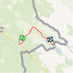
Trail Walking of 5.3 km to be discovered at Provence-Alpes-Côte d'Azur, Alpes-de-Haute-Provence, Val-d'Oronaye. This trail is proposed by andre06130.
Positioning
Country:
France
Region :
Provence-Alpes-Côte d'Azur
Department/Province :
Alpes-de-Haute-Provence
Municipality :
Val-d'Oronaye
Location:
Larche
Start:(Dec)
Start:(UTM)
332016 ; 4921580 (32T) N.
Comments
Lac du Roburent (italie)