


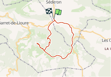
SEDERON .source de la meouge .col du seuil . col du negron o

RobinMicheline
User GUIDE

Length
14.4 km

Max alt
1331 m

Uphill gradient
573 m
Km-Effort
22 km

Min alt
840 m

Downhill gradient
570 m
Boucle
Yes
Creation date :
2019-10-16 07:22:00.456
Updated on :
2020-01-22 19:24:23.372
6h34
Difficulty : Medium

FREE GPS app for hiking
 SityTrail
IGN / Geographical institutes
SityTrail Plus
The world is yours!
About
Trail Walking of 14.4 km to be discovered at Auvergne-Rhône-Alpes, Drôme, Séderon. This trail is proposed by RobinMicheline.
Description
5 h de marche
sympa. champignons
Positioning
Country:
France
Region :
Auvergne-Rhône-Alpes
Department/Province :
Drôme
Municipality :
Séderon
Location:
Unknown
Start:(Dec)
Start:(UTM)
702824 ; 4895977 (31T) N.
Comments