Trail Other activity Binn - Wallis ins Tessin 2. Tag - Photo

Wallis ins Tessin 2. Tag

 U106659
U106659

User

© OpenStreetMap contributors
Length
Length
17 km
Max alt
Max alt
2598 m
Uphill gradient
Uphill gradient
983 m
Km-Effort
Km-Effort  
32 km
Min alt
Min alt
1732 m
Downhill gradient
Downhill gradient
1514 m
Boucle
Boucle
No
Creation date :
2014-12-11 00:00:00.0
Updated on :
2014-12-11 00:00:00.0

(0 Reviews)

Other activity
Other activity
--
Difficulty : Unknown

Scan this QR Code to open this trail in the SityTrail application

FREE GPS app for hiking

Logo SityTrail SityTrail

IGN / Geographical institutes

Download SityTrail from the App Store Download SityTrail from Google Play

Logo SityTrail SityTrail World

The world is yours!

Download SityTrail from the App Store Download SityTrail from Google Play Download SityTrail on Huawei AppGallery

About

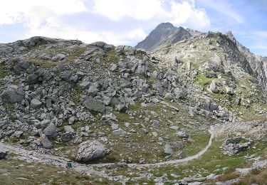
Trail Other activity of 17 km to be discovered at Valais/Wallis, Goms, Binn. This trail is proposed by U106659.

Description

Von Binn via Albrunpass und dem Formazzatal ins Valle Maggia

Binntalhütte SAC - Riale

Elevation profile

Positioning

Country:
Switzerland
Region :
Valais/Wallis
Department/Province :
Goms
Municipality :
Binn
Location:
Unknown
Start:(UTM)
445534 ; 5135921 (32T) N.

Trails nearby

Trail On foot Binn - Via dell' Arbola tappa 2 CH - Photo
On foot
PRO

On foot

Easy
Binn, Valais/Wallis, Goms, Switzerland
11.4 km | 15.2 km-effort
3h 27min
No
Trail Other activity Binn - Walser 2 - Photo
Other activity
pierrepraz

Other activity

Very easy
Binn, Valais/Wallis, Goms, Switzerland
11.6 km | 22 km-effort
Unknown
No
Trail Other activity Binn - Wallis ins Tessin 2. Tag Route Variante A - Photo
Other activity
U106659

Other activity

Very easy
Binn, Valais/Wallis, Goms, Switzerland
8.9 km | 16.8 km-effort
Unknown
No


Close
My subscriptions