Trail Other activity Eischoll - Export 100''000 - Photo
 dondon
dondon

User

© OpenStreetMap contributors
Length
Length
18.1 km
Max alt
Max alt
3025 m
Uphill gradient
Uphill gradient
2523 m
Km-Effort
Km-Effort  
52 km
Min alt
Min alt
1821 m
Downhill gradient
Downhill gradient
2559 m
Boucle
Boucle
No
Creation date :
2014-12-11 00:00:00.0
Updated on :
2014-12-11 00:00:00.0

(0 Reviews)

Other activity
Other activity
--
Difficulty : Unknown

Scan this QR Code to open this trail in the SityTrail application

FREE GPS app for hiking

Logo SityTrail SityTrail

IGN / Geographical institutes

Download SityTrail from the App Store Download SityTrail from Google Play

Logo SityTrail SityTrail World

The world is yours!

Download SityTrail from the App Store Download SityTrail from Google Play Download SityTrail on Huawei AppGallery

About

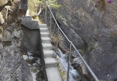
Trail Other activity of 18.1 km to be discovered at Valais/Wallis, Westlich Raron, Eischoll. This trail is proposed by dondon.

Description

Trimbach-Rotenfluh-Oberfrich...

Elevation profile

Positioning

Country:
Switzerland
Region :
Valais/Wallis
Department/Province :
Westlich Raron
Municipality :
Eischoll
Location:
Unknown
Start:(UTM)
404315 ; 5126048 (32T) N.

Trails nearby

Trail Other activity Turtmann-Unterems - y10_stockweg - Photo
Other activity
GUIDE+

Other activity

Very easy
Turtmann-Unterems, Valais/Wallis, Leuk, Switzerland
8 km | 13.7 km-effort
3h 20min
No
Trail Other activity Oberems - y10_oberems_chandolin - Photo
Other activity
GUIDE+

Other activity

Very easy
Oberems, Valais/Wallis, Leuk, Switzerland
13.5 km | 33 km-effort
7h 26min
No
Trail Other activity Oberems - y10_turtmanntal - Photo
Other activity
GUIDE+

Other activity

Very easy
Oberems, Valais/Wallis, Leuk, Switzerland
20 km | 36 km-effort
8h 35min
Yes
Trail Other activity Turtmann-Unterems - y10_baerenpfad_unterems - Photo
Other activity
GUIDE+

Other activity

Very easy
Turtmann-Unterems, Valais/Wallis, Leuk, Switzerland
6.4 km | 11.9 km-effort
2h 55min
No
Trail Walking Steg-Hohtenn - Hohtenn Lalden: Lötschberg-Südrampe - Photo
Walking
GUIDE+

Walking

Very easy
Steg-Hohtenn, Valais/Wallis, Westlich Raron, Switzerland
21 km | 33 km-effort
Unknown
No
Trail Walking Turtmann-Unterems - Turtmanntal: Von Wasserfall zu Wasserfall - Photo
Walking
GUIDE+

Walking

Very easy
Turtmann-Unterems, Valais/Wallis, Leuk, Switzerland
10.1 km | 19.7 km-effort
Unknown
Yes
Trail Walking Steg-Hohtenn - st_koreatv08_03 - Photo
Walking
GUIDE+

Walking

Very easy
Steg-Hohtenn, Valais/Wallis, Westlich Raron, Switzerland
36 km | 105 km-effort
7h 24min
No
Trail Walking Steg-Hohtenn - 2 bisses depuis Hohtenn 06.04.17 - Photo
Walking
duamerg

Walking

Medium
Steg-Hohtenn, Valais/Wallis, Westlich Raron, Switzerland
7.8 km | 12.5 km-effort
2h 59min
Yes
Trail Other activity Steg-Hohtenn - 14 10 09 Alpjoly - Photo
Other activity
mjoseph

Other activity

Very easy
Steg-Hohtenn, Valais/Wallis, Westlich Raron, Switzerland
10.5 km | 22 km-effort
Unknown
Yes


Close
My subscriptions